The ongoing geopolitical dynamics in the Middle East often bring Israel into sharp focus. Understanding the geographical context of this nation is crucial to grasping the complexities of the region. While headlines frequently discuss Israel’s conflicts and technological advancements, a fundamental aspect often overlooked is its size, especially when juxtaposed against a vast nation like the United States. How does the physical size of Israel truly compare to the United States, and what are the implications of this difference?
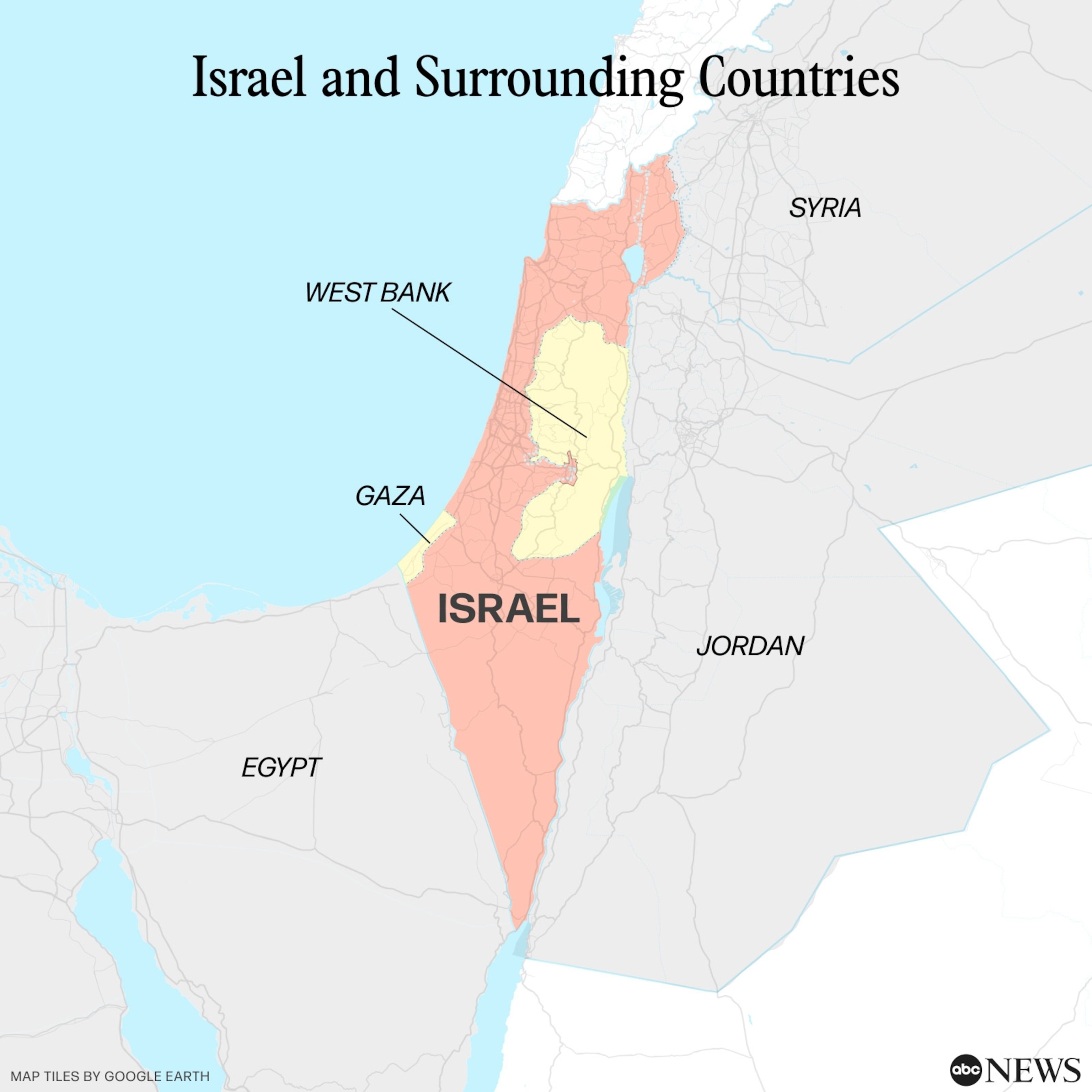
Israel, a country located on the eastern edge of the Mediterranean Sea, is bordered by nations that have been central to its history and security concerns. Its neighbors include Egypt, Lebanon, Syria, and Jordan, all of whom have, at various times, been involved in conflicts with Israel since its declaration of independence in 1948. This geographic placement, combined with its dimensions, creates a unique set of circumstances for the nation.
To truly grasp the scale, consider the numbers. Israel encompasses a total land area of approximately 8,469 square miles. Coupled with a population of around 9.3 million people, this results in a high population density of roughly 1,098 people per square mile. This compactness is a defining characteristic of Israel.
In stark contrast, the United States sprawls across approximately 3.8 million square miles. With an estimated population of 333 million, the population density is significantly lower at about 87 people per square mile. These figures highlight a massive difference in scale. To put it into perspective, you could fit approximately 450 Israels within the landmass of the United States.
For an even more relatable comparison within the US context, experts often equate Israel’s size to that of New Jersey. New Jersey covers 8,722 square miles and also has a population mirroring Israel’s, around 9.3 million. This comparison helps Americans visualize Israel’s dimensions – picture the entire nation of Israel fitting within a state like New Jersey.
Imagine the implications of this size difference, especially in terms of national security and defense. In a country as compact as Israel, the proximity is both a strength and a vulnerability. As Steven E. Zipperstein, an expert from UCLA’s Luskin School of Public Affairs, points out, this density means resources can be mobilized rapidly. Military bases, personnel, and even short-range missile systems are inherently close to potential points of conflict. The response time can be minimal due to the short distances involved.
However, this compactness also means that threats are immediate and pervasive. The entire nation and its infrastructure are within relatively easy reach of adversaries. As Zipperstein illustrates with the analogy of rockets fired across the Hudson River into Newark, the time to react to threats can be critically short. The rocket attacks from Gaza into nearby Israeli cities like Ashkelon exemplify this danger. When alarms sound, residents may have only seconds to find shelter.
Despite these vulnerabilities inherent to its size, Israel has developed sophisticated strategies to counter these challenges. The Iron Dome air defense system, cyber warfare capabilities, and advanced technology are all examples of how Israel adapts to its geographic realities. These innovations are crucial for a nation where borders are close and the depth for strategic retreat is limited.
In conclusion, understanding the size of Israel in comparison to the United States, or even a US state like New Jersey, provides crucial context for grasping the nation’s unique security and geopolitical situation. Its small size is a double-edged sword, offering both rapid mobilization capabilities and heightened vulnerability. This geographic reality is a key factor in understanding the decades of conflict and the innovative defense strategies Israel has developed to navigate its complex regional environment.