Planning a trip to New Zealand and curious about its size relative to the United States? It’s a common question for travelers, especially when considering distances and travel times within a new country. Understanding the scale of New Zealand compared to the USA is crucial for effective trip planning.
New Zealand vs. USA: Land Area Comparison
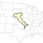
 New Zealand Size Comparison US
In terms of landmass, New Zealand is considerably smaller than the United States. To put it into perspective, New Zealand’s total land area is approximately 103,738 square miles (268,680 square kilometers). This is roughly comparable to the size of the US state of Colorado, which covers around 104,094 square miles. Imagine the state of Colorado – that’s essentially the land area you’re looking at when you think about New Zealand.
However, the United States is vastly larger, boasting a total land area of about 3.8 million square miles (9.8 million square kilometers). This means the US is approximately 37 times larger than New Zealand in terms of land area.
Population Size: New Zealand and the US States
When considering population, the contrast is also significant. New Zealand’s population is estimated to be just over 5 million people. This is similar to the population of the US state of Louisiana, which has around 4.6 million residents.
On the other hand, the United States has a population of over 330 million people. This highlights a key difference: while New Zealand’s land area is comparable to a single US state, its population density is much lower compared to the US overall. This contributes to New Zealand’s reputation for wide-open spaces and relatively uncrowded landscapes outside of urban centers.
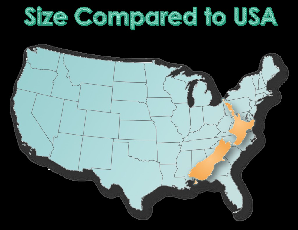
The North-South Stretch of New Zealand
One important aspect to understand about New Zealand’s size is its shape. The country is long and narrow, stretching from north to south. If you were to overlay New Zealand onto a map of the eastern United States, it would extend roughly from Florida up to Pennsylvania along the coastline.
This north-south orientation means that while the total area isn’t enormous, traveling from the top of the North Island to the bottom of the South Island involves a significant distance. This elongated shape impacts travel planning within New Zealand.
Planning Your New Zealand Trip: Consider the Distances
Because of New Zealand’s stretched shape, it’s essential for travelers to plan their itineraries carefully, taking travel times and distances into account. While it might appear small on a world map, moving between different regions can take time.
New Zealand offers various transportation options, including domestic flights, inter-city buses, and scenic train journeys. While traveling by bus and train is generally affordable, longer distances between regions can increase travel time and costs. With 28 diverse regions to explore, prioritizing your must-see destinations is key to making the most of your trip.
In conclusion, while New Zealand is geographically comparable to the US state of Colorado in land area, it is considerably smaller than the entire United States. Its elongated north-south shape means that distances within the country are significant for travel planning. Understanding this size comparison is the first step in preparing for an unforgettable New Zealand adventure.