How Big Is Michigan Compared To Other States? Discover the size of Michigan and see how it stacks up against other states with COMPARE.EDU.VN. Explore the geographical area, notable comparisons, and factors influencing its ranking, offering insight into its relative size and significance. Uncover details about land area, water coverage, and overall dimensions.
1. Understanding Michigan’s Size and Geography
Michigan, known for its unique shape and stunning Great Lakes coastline, occupies a significant space within the United States. Understanding its size requires looking at various factors, including its total area, land area, and water coverage. Knowing these details provides a comprehensive view of Michigan’s geographical footprint and how it measures up against other states. For individuals needing to make decisions based on location, geographical understanding, and comparisons, this is an essential aspect to consider.
1.1. Total Area of Michigan
Michigan’s total area encompasses both land and water, painting a complete picture of the state’s size. The total area is crucial for understanding the state’s overall geographical significance. According to the U.S. Census Bureau, Michigan’s total area is approximately 96,716 square miles (250,518 square kilometers).[1] This figure includes all land and water within the state’s boundaries, making it a key metric for comparison. This figure is significant for regional planning, environmental studies, and economic development considerations.
1.2. Land Area vs. Water Area
Breaking down the total area into land and water provides a more detailed understanding of Michigan’s composition. The land area is the portion of the state that is solid ground, while the water area includes the Great Lakes and other bodies of water within its borders.
- Land Area: Michigan’s land area is approximately 56,539 square miles (146,436 square kilometers).[2]
- Water Area: The water area, primarily consisting of the Great Lakes, covers about 40,177 square miles (104,057 square kilometers).[2]
This substantial water area significantly influences Michigan’s climate, economy, and recreational opportunities. The extensive coastline along the Great Lakes supports industries such as fishing, shipping, and tourism. The state’s rich water resources are a major factor in its overall appeal and importance.
1.3. How Does Michigan Rank Among Other States?
When considering total area, Michigan ranks 11th among the 50 United States. This placement is influenced significantly by its large water area. However, when only considering land area, Michigan’s ranking drops. To better understand Michigan’s relative size, it’s helpful to compare it to states with similar geographical compositions.
- Total Area: Ranked 11th
- Land Area: Ranked 22nd
These rankings provide context on where Michigan stands in terms of size compared to other states, highlighting the impact of its water resources on its overall geographical footprint. States like Minnesota and Wisconsin also have substantial water areas, making them useful points of comparison.
2. Michigan vs. Other States: A Detailed Comparison
To fully appreciate the size of Michigan, it’s essential to compare it with other states. This comparison will look at states larger and smaller than Michigan, offering a better understanding of its relative size and geographical context.
2.1. States Larger Than Michigan
Several states are significantly larger than Michigan in terms of total area. These states often have diverse landscapes and economies that benefit from their extensive size.
- Alaska: The largest state in the U.S., Alaska, has a total area of over 665,000 square miles, dwarfing Michigan.
- Texas: With a total area of approximately 268,000 square miles, Texas is more than 2.5 times the size of Michigan.
- California: California’s diverse landscape covers about 163,000 square miles, making it significantly larger than Michigan.
- Montana: Covering around 147,000 square miles, Montana offers vast expanses of wilderness, exceeding Michigan in size.
- New Mexico: With approximately 121,000 square miles, New Mexico’s desert and mountain regions make it larger than Michigan.
- Arizona: Arizona’s total area is about 113,000 square miles, providing extensive landscapes and resources.
- Nevada: Covering approximately 110,000 square miles, Nevada is primarily desert and mountainous terrain.
- Colorado: With a total area of roughly 104,000 square miles, Colorado’s Rocky Mountains contribute to its larger size compared to Michigan.
- Oregon: Oregon’s diverse geography covers about 98,000 square miles, slightly larger than Michigan.
- Wyoming: Wyoming is slightly larger than Michigan, with a total area of approximately 97,814 square miles.
These comparisons highlight the considerable difference in size between Michigan and the largest states in the U.S.
2.2. States Smaller Than Michigan
Conversely, many states are smaller than Michigan, each with unique characteristics and contributions to the country.
- Kansas: Slightly smaller than Michigan, Kansas covers approximately 82,000 square miles.
- Utah: Utah has a total area of roughly 84,900 square miles, known for its national parks and mountainous terrain.
- Minnesota: With a total area of about 87,000 square miles, Minnesota is known for its lakes and forests.
- Idaho: Idaho’s total area is approximately 83,500 square miles, featuring rugged mountains and extensive wilderness.
- South Dakota: Covering around 77,000 square miles, South Dakota offers vast prairies and significant historical sites.
- Washington: With a total area of about 71,300 square miles, Washington’s diverse geography includes rainforests and mountains.
- North Dakota: North Dakota’s total area is approximately 70,700 square miles, characterized by plains and agricultural lands.
- Oklahoma: Covering roughly 70,000 square miles, Oklahoma features diverse landscapes from forests to grasslands.
- Missouri: Missouri’s total area is about 69,700 square miles, with a mix of forests, plains, and waterways.
- Florida: Florida has a total area of approximately 65,700 square miles, famous for its coastlines and wetlands.
- Wisconsin: Wisconsin covers around 65,500 square miles, known for its dairy farms and brewing industry.
- Georgia: With a total area of about 59,400 square miles, Georgia features coastal plains and mountain regions.
- Illinois: Illinois has a total area of approximately 57,900 square miles, characterized by flat prairies and urban centers.
- Iowa: Covering around 56,300 square miles, Iowa is predominantly agricultural land.
- New York: New York’s total area is about 54,500 square miles, featuring urban landscapes and natural reserves.
- North Carolina: With a total area of approximately 53,800 square miles, North Carolina offers both coastal and mountain regions.
- Arkansas: Arkansas covers roughly 53,200 square miles, known for its forests and mountainous areas.
- Alabama: Alabama has a total area of approximately 52,400 square miles, featuring coastal plains and diverse ecosystems.
- Louisiana: Covering around 52,300 square miles, Louisiana is known for its wetlands and cultural heritage.
- Mississippi: Mississippi’s total area is about 48,400 square miles, characterized by forests and agricultural lands.
- Pennsylvania: Pennsylvania has a total area of approximately 46,000 square miles, with urban and rural landscapes.
- Ohio: Ohio covers roughly 44,800 square miles, known for its industrial and agricultural sectors.
- Virginia: With a total area of about 42,700 square miles, Virginia offers coastal and mountainous regions.
- Tennessee: Tennessee has a total area of approximately 42,100 square miles, featuring diverse terrains.
- Kentucky: Covering around 40,500 square miles, Kentucky is known for its bluegrass region and horse farms.
- Indiana: Indiana’s total area is about 36,400 square miles, characterized by flat plains and agricultural lands.
- Maine: Maine has a total area of approximately 35,400 square miles, known for its rocky coastline and forests.
- South Carolina: Covering roughly 32,000 square miles, South Carolina features coastal plains and beaches.
- West Virginia: West Virginia’s total area is about 24,200 square miles, characterized by mountainous terrain.
- Maryland: Maryland has a total area of approximately 12,400 square miles, featuring coastal and urban areas.
- Hawaii: Covering around 10,900 square miles, Hawaii is an archipelago of volcanic islands.
- Massachusetts: With a total area of about 10,600 square miles, Massachusetts includes urban and coastal landscapes.
- Vermont: Vermont has a total area of approximately 9,600 square miles, known for its green mountains and rural character.
- New Hampshire: Covering roughly 9,300 square miles, New Hampshire features mountains and forests.
- New Jersey: New Jersey’s total area is about 8,700 square miles, characterized by urban and coastal regions.
- Connecticut: Connecticut has a total area of approximately 5,500 square miles, featuring coastal and rural areas.
- Delaware: Covering around 2,500 square miles, Delaware is known for its coastal plains.
- Rhode Island: Rhode Island’s total area is about 1,500 square miles, featuring coastal landscapes and urban areas.
These comparisons help illustrate how Michigan’s size fits into the broader context of the United States.
2.3. Comparing Michigan to Other Great Lakes States
Given Michigan’s significant connection to the Great Lakes, comparing it to other states bordering these lakes provides additional context.
- Minnesota: Minnesota, while having a smaller total area (approximately 87,000 square miles), shares a border with Lake Superior and has a substantial water area.
- Wisconsin: Wisconsin covers around 65,500 square miles and borders Lake Michigan and Lake Superior, emphasizing its water-based resources.
- Ohio: Ohio, with approximately 44,800 square miles, borders Lake Erie and benefits from its access to the Great Lakes.
- New York: New York, covering about 54,500 square miles, borders Lake Erie and Lake Ontario, contributing to its diverse economic activities.
- Illinois: Illinois has a total area of approximately 57,900 square miles and borders Lake Michigan.
- Pennsylvania: Pennsylvania has a total area of approximately 46,000 square miles and borders Lake Erie.
- Indiana: Indiana’s total area is about 36,400 square miles and borders Lake Michigan.
These states share similar economic and environmental concerns related to the Great Lakes, but their sizes vary significantly, highlighting the diverse characteristics of the region.
3. Factors Influencing Michigan’s Size Ranking
Several factors contribute to Michigan’s ranking among the states in terms of size. Understanding these influences provides a deeper appreciation for Michigan’s geographical and environmental context.
3.1. Impact of the Great Lakes
The Great Lakes significantly influence Michigan’s total area. The state borders four of the five Great Lakes: Superior, Michigan, Huron, and Erie. This extensive water coverage dramatically increases Michigan’s total area, positioning it higher in the rankings compared to land-area-only metrics.
- Economic Impact: The Great Lakes support industries such as shipping, fishing, and tourism, contributing to Michigan’s economy.
- Environmental Impact: The lakes moderate the state’s climate and provide crucial freshwater resources.
3.2. Geographical Features
Michigan’s unique geographical features also play a role in its size and shape. The state is divided into two peninsulas: the Upper Peninsula (UP) and the Lower Peninsula (LP).
- Upper Peninsula: The UP is characterized by rugged terrain, forests, and mineral deposits, contributing to its distinct character.
- Lower Peninsula: The LP is more populated and features diverse landscapes, including farmland, forests, and urban areas.
These geographical features influence land use, population distribution, and economic activities across the state.
3.3. Historical and Political Boundaries
Historical and political factors have also shaped Michigan’s current boundaries. The state’s borders were established through treaties, land acquisitions, and political negotiations, influencing its final size and shape. Understanding these historical processes provides context for Michigan’s present-day geographical footprint.
4. Why Size Comparisons Matter
Understanding the size of a state like Michigan relative to others has practical implications for various sectors.
4.1. Economic Planning
Size affects economic planning by influencing resource allocation, infrastructure development, and market access. Larger states may have greater resource endowments but also face challenges in managing vast distances and diverse economies.
- Infrastructure: Planning for roads, railways, and utilities must account for the state’s geographical spread.
- Resource Management: Managing natural resources, such as water, forests, and minerals, requires strategies tailored to the state’s size and environmental conditions.
4.2. Environmental Management
Environmental management is closely tied to a state’s size. Larger states may have greater biodiversity and face more complex environmental challenges, such as air and water pollution, habitat loss, and climate change impacts.
- Conservation Efforts: Protecting ecosystems and endangered species requires comprehensive strategies across large geographical areas.
- Pollution Control: Addressing pollution issues involves managing industrial activities, agricultural practices, and urban development.
4.3. Political Representation
A state’s size can influence its political representation and influence within the federal system. Larger states often have larger populations, translating to more representatives in Congress and greater electoral power.
- Congressional Representation: The number of representatives a state has in the House of Representatives is based on its population.
- Electoral College: The number of electoral votes a state has in presidential elections is determined by its total number of representatives and senators.
5. Exploring Michigan: Key Geographical Facts
Delving deeper into Michigan’s geography reveals interesting facts that highlight its unique attributes.
5.1. Coastline Length
Michigan boasts the longest freshwater coastline in the United States, primarily due to its extensive border with the Great Lakes. The coastline stretches over 3,200 miles, providing numerous recreational opportunities and supporting coastal communities.
5.2. Island Count
Michigan has numerous islands, ranging from small, uninhabited islets to larger, populated islands like Isle Royale and Drummond Island. These islands contribute to the state’s diverse ecosystems and offer unique tourism opportunities.
5.3. Elevation Extremes
Michigan’s elevation varies significantly, from the lowest point along Lake Erie (571 feet above sea level) to the highest point at Mount Arvon (1,979 feet above sea level) in the Upper Peninsula. This variation in elevation contributes to the state’s diverse landscapes and habitats.
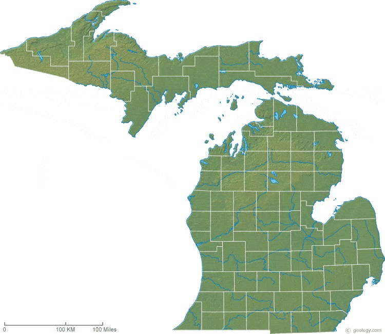 Michigan Elevation Map
6. Michigan’s Natural Resources and Economy
Michigan’s size and geography play a crucial role in shaping its economy and natural resource management.
6.1. Agricultural Significance
Agriculture is a significant sector in Michigan, benefiting from the state’s fertile soil and favorable climate. The state produces a variety of crops, including fruits, vegetables, and grains. Its size allows for large-scale farming operations and supports a diverse agricultural economy.
6.2. Mineral Resources
Michigan has a rich history of mineral extraction, particularly in the Upper Peninsula. Iron ore, copper, and other minerals have been mined extensively, contributing to the state’s industrial development. The availability of these resources is closely linked to Michigan’s geographical composition.
6.3. Tourism and Recreation
Tourism is a major industry in Michigan, driven by its natural beauty and recreational opportunities. The Great Lakes, forests, and diverse landscapes attract visitors year-round. The state’s size allows for a wide range of outdoor activities, from boating and fishing to hiking and skiing.
7. Conclusion: The Significance of Michigan’s Size
In summary, Michigan’s size is a significant factor influencing its economy, environment, and political landscape. Its total area of approximately 96,716 square miles ranks it 11th among the United States, a position heavily influenced by its extensive water area. Comparing Michigan to other states reveals its unique place in the nation, with its geographical features, historical context, and natural resources contributing to its distinct character.
Understanding these aspects is crucial for anyone looking to make informed decisions related to business, travel, or relocation. Whether you are comparing investment opportunities, planning a vacation, or considering a move, knowing the relative size and characteristics of Michigan can provide valuable insights.
For those seeking more detailed comparisons and information to aid in decision-making, visit COMPARE.EDU.VN. Our platform offers comprehensive analyses and comparisons across various categories, helping you make informed choices. Contact us at 333 Comparison Plaza, Choice City, CA 90210, United States, or reach us via WhatsApp at +1 (626) 555-9090. Make smarter decisions with compare.edu.vn.
8. Frequently Asked Questions (FAQ) About Michigan’s Size
-
How does Michigan’s total area compare to other states?
Michigan ranks 11th in total area among the 50 United States, primarily due to its large water area from the Great Lakes. -
What is the land area of Michigan?
Michigan’s land area is approximately 56,539 square miles (146,436 square kilometers). -
What is the water area of Michigan?
The water area of Michigan is approximately 40,177 square miles (104,057 square kilometers). -
How many Great Lakes does Michigan border?
Michigan borders four of the five Great Lakes: Superior, Michigan, Huron, and Erie. -
What are the main geographical features of Michigan?
Michigan consists of two peninsulas: the Upper Peninsula (UP) and the Lower Peninsula (LP). The UP is known for its rugged terrain and forests, while the LP has diverse landscapes, including farmland and urban areas. -
How does Michigan’s size influence its economy?
Michigan’s size influences its economy by supporting industries such as agriculture, tourism, and mineral extraction. Its extensive coastline and natural resources drive economic activities across the state. -
What is the highest point in Michigan?
The highest point in Michigan is Mount Arvon, with an elevation of 1,979 feet above sea level, located in the Upper Peninsula. -
How long is Michigan’s coastline?
Michigan boasts the longest freshwater coastline in the United States, stretching over 3,200 miles. -
How does Michigan’s size affect its political representation?
Michigan’s size and population influence its political representation in Congress. The state has a certain number of representatives in the House of Representatives based on its population. -
What are some of the environmental challenges Michigan faces due to its size?
Michigan faces environmental challenges such as air and water pollution, habitat loss, and climate change impacts, which require comprehensive management strategies across its large geographical area.