How big is Greenland compared to the US? This question often arises due to the distortions present in common world maps. At COMPARE.EDU.VN, we delve into the true size of Greenland, offering a precise comparison with the United States and other countries, helping you understand geographical scales accurately. Discover insightful comparisons and make informed decisions with comprehensive data.
1. Understanding Greenland’s True Size
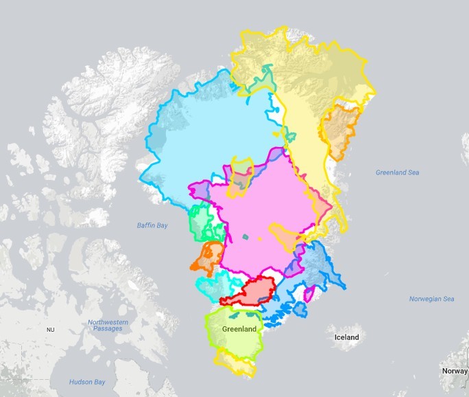
Greenland, an autonomous territory within the Kingdom of Denmark, is the world’s largest island that is not a continent. Its sheer size often leads to misinterpretations when viewed on traditional world maps like the Mercator projection. These maps distort sizes, particularly towards the poles, making Greenland appear significantly larger than it actually is.
- Geographical Context: Greenland is located between the Arctic and Atlantic Oceans, primarily in the North American continent. It spans approximately 2,166,086 square kilometers (836,330 square miles).
- Why Size Matters: Understanding the actual size of Greenland is vital for various reasons, including geographical studies, climate change analysis, and geopolitical considerations.
2. Greenland vs. the United States: A Detailed Comparison
To accurately gauge Greenland’s size, a direct comparison with the United States is necessary.
2.1. Land Area
- Greenland: Approximately 2,166,086 square kilometers (836,330 square miles).
- United States: Approximately 9,833,520 square kilometers (3,796,742 square miles).
As the figures indicate, the United States is significantly larger than Greenland. To put it in perspective, Greenland is about 4.5 times smaller than the United States.
2.2. Population Density
- Greenland: With a population of around 56,000 people, Greenland has one of the lowest population densities in the world.
- United States: The United States has a population of over 330 million people, resulting in a much higher population density.
This stark contrast in population density highlights the vast uninhabited areas in Greenland, primarily due to its harsh Arctic climate and extensive ice cover.
2.3. Geographical Features
- Greenland: Dominated by the Greenland Ice Sheet, which covers about 80% of the island. The remaining ice-free areas are primarily along the coast.
- United States: Features a diverse landscape, including mountains, plains, deserts, and forests, distributed across its vast territory.
The contrasting geographical features influence the climate, habitability, and economic activities in both regions.
3. Visualizing the Size Difference
To better understand the disparity in size, consider these analogies:
- State Comparisons: Greenland is roughly the size of Alaska (1,717,856 square kilometers) and Texas (695,662 square kilometers) combined, yet still smaller than the contiguous United States.
- Map Overlays: Overlaying Greenland onto a map of the United States reveals that it could fit several times within the US, spanning multiple states.
4. The Mercator Projection and Size Distortion
The Mercator projection, created in 1569, is a cylindrical map projection that preserves angles and shapes but distorts the size of landmasses, especially those farther from the equator.
4.1. How Mercator Distorts Greenland’s Size
On a Mercator map, Greenland appears to be nearly the same size as Africa, which is far from accurate. Africa’s land area is approximately 30.37 million square kilometers, making it about 14 times larger than Greenland.
4.2. Alternative Map Projections
To avoid size distortion, alternative map projections like the Gall-Peters projection or the Winkel tripel projection are used. These projections accurately represent the area of countries, providing a more realistic view of their relative sizes.
5. Comparison with Other Countries and Regions
Besides the United States, comparing Greenland to other countries and regions further illustrates its actual size.
5.1. Greenland vs. Australia
- Australia: Approximately 7.69 million square kilometers.
- Comparison: Australia is about 3.5 times larger than Greenland.
5.2. Greenland vs. Europe
- Europe (excluding Russia): Approximately 10.18 million square kilometers.
- Comparison: Europe is about 4.7 times larger than Greenland.
5.3. Greenland vs. India
- India: Approximately 3.29 million square kilometers.
- Comparison: India is about 1.5 times larger than Greenland.
These comparisons underscore that while Greenland is a large island, it is considerably smaller than major countries and continents.
6. Why Map Projections Matter
The choice of map projection significantly influences how we perceive the world.
6.1. Political and Social Implications
Distorted maps can affect our understanding of global power dynamics and resource distribution. Accurate maps are crucial for fair representation and informed decision-making.
6.2. Educational Importance
Teaching geography with accurate map projections helps students develop a more realistic understanding of the world, fostering a global perspective based on facts rather than visual distortions.
7. The Greenland Ice Sheet: An Important Consideration
The Greenland Ice Sheet is a massive body of ice covering most of Greenland. Its size and impact on global sea levels make it a critical area of study.
7.1. Size and Volume
The ice sheet covers about 1.7 million square kilometers and contains approximately 2.9 million cubic kilometers of ice.
7.2. Impact on Sea Levels
If the entire Greenland Ice Sheet were to melt, global sea levels would rise by approximately 7 meters (23 feet), posing a significant threat to coastal communities worldwide.
7.3. Climate Change Implications
The melting of the Greenland Ice Sheet is accelerating due to climate change, making it a key indicator of global warming and its potential consequences.
8. Greenland’s Geography and Climate
Understanding Greenland’s geography and climate provides additional context to its size and importance.
8.1. Arctic Climate
Greenland experiences an Arctic climate characterized by cold temperatures, long winters, and short summers. The average temperature in the warmest month (July) is just above freezing in many coastal areas.
8.2. Coastal Regions
Most of Greenland’s population lives in coastal areas, where conditions are slightly milder. These regions are also important for fishing and other marine activities.
8.3. Natural Resources
Greenland possesses valuable natural resources, including minerals, oil, and gas. However, the extraction of these resources is challenging due to the harsh climate and remote location.
9. Greenland’s Political and Economic Landscape
Greenland’s political and economic structure is unique, reflecting its status as an autonomous territory within the Kingdom of Denmark.
9.1. Self-Governance
Greenland has its own parliament and government, responsible for most domestic affairs. Denmark retains control over foreign policy and defense.
9.2. Economic Activities
The economy of Greenland is primarily based on fishing, hunting, and tourism. The government also receives substantial financial support from Denmark.
9.3. Geopolitical Significance
Greenland’s strategic location in the Arctic region makes it geopolitically significant, particularly in the context of climate change and resource competition.
10. Exploring Greenland: Tourism and Accessibility
Despite its remote location and harsh climate, Greenland is becoming an increasingly popular tourist destination.
10.1. Tourist Attractions
Popular attractions include icebergs, glaciers, fjords, and the Northern Lights. Visitors can also experience Inuit culture and traditions.
10.2. Accessibility
Greenland is accessible by air and sea. International flights connect Greenland with Denmark and Iceland, while cruise ships offer tours of the coastline.
10.3. Challenges for Tourism
The high cost of travel and limited infrastructure pose challenges for tourism development in Greenland.
11. The Impact of Climate Change on Greenland
Climate change is having a profound impact on Greenland, with far-reaching consequences for the island and the rest of the world.
11.1. Accelerated Ice Melt
Rising temperatures are causing the Greenland Ice Sheet to melt at an accelerated rate, contributing to global sea-level rise.
11.2. Changes in Ecosystems
The melting ice is also affecting ecosystems, altering habitats and impacting wildlife populations.
11.3. Opportunities and Challenges
While climate change poses significant challenges, it also creates new opportunities, such as increased access to natural resources and new shipping routes.
12. Future Projections and Research
Ongoing research and monitoring efforts are crucial for understanding the future of Greenland in a changing climate.
12.1. Scientific Studies
Scientists are studying the dynamics of the Greenland Ice Sheet, the impact of climate change on ecosystems, and the potential for sustainable development.
12.2. Modeling and Predictions
Climate models are used to project future changes in temperature, ice melt, and sea-level rise, providing valuable information for policymakers and planners.
12.3. International Collaboration
Addressing the challenges posed by climate change in Greenland requires international collaboration and cooperation.
13. Greenland in Popular Culture and Media
Greenland’s unique landscape and cultural heritage have captured the imagination of artists, writers, and filmmakers.
13.1. Literature and Film
Greenland has been featured in numerous books, movies, and documentaries, showcasing its natural beauty and the lives of its inhabitants.
13.2. Art and Music
Artists and musicians draw inspiration from Greenland’s landscapes, creating works that reflect its unique character.
13.3. Cultural Representation
Accurate and respectful representation of Greenland in popular culture is important for promoting understanding and appreciation of its cultural heritage.
14. The Importance of Accurate Geographical Data
Accurate geographical data is essential for a wide range of applications, from navigation and mapping to environmental monitoring and disaster response.
14.1. Navigation Systems
GPS and other navigation systems rely on accurate geographical data to provide precise location information.
14.2. Environmental Monitoring
Scientists use geographical data to monitor changes in land use, vegetation cover, and ice extent, providing valuable insights into environmental trends.
14.3. Disaster Response
Accurate maps and geographical information are critical for planning and executing disaster response efforts, helping to save lives and minimize damage.
15. Conclusion: Understanding Greenland’s Place in the World
Understanding the true size of Greenland compared to the United States and other regions is essential for a more accurate and informed view of the world. By correcting common misconceptions perpetuated by distorted maps, we can better appreciate the geographical, environmental, and geopolitical significance of this unique island.
16. COMPARE.EDU.VN: Your Go-To Source for Accurate Comparisons
At COMPARE.EDU.VN, we are committed to providing accurate, detailed, and objective comparisons to help you make informed decisions. Whether you’re comparing geographical sizes, product features, or service options, our platform offers the information you need to choose with confidence. Explore our site today and discover the power of informed comparison.
17. Frequently Asked Questions (FAQ)
17.1. How big is Greenland compared to the United States?
Greenland is approximately 4.5 times smaller than the United States in terms of land area.
17.2. Why does Greenland appear so large on some maps?
The Mercator projection, commonly used in many world maps, distorts the size of landmasses, particularly those far from the equator, making Greenland appear larger than it is.
17.3. What is the Greenland Ice Sheet?
The Greenland Ice Sheet is a massive body of ice covering about 80% of Greenland. It contains approximately 2.9 million cubic kilometers of ice.
17.4. How much would sea levels rise if the Greenland Ice Sheet melted?
If the entire Greenland Ice Sheet were to melt, global sea levels would rise by approximately 7 meters (23 feet).
17.5. What are some alternative map projections that accurately represent size?
Alternative map projections that accurately represent size include the Gall-Peters projection and the Winkel tripel projection.
17.6. What is the population of Greenland?
Greenland has a population of around 56,000 people.
17.7. What are the main economic activities in Greenland?
The economy of Greenland is primarily based on fishing, hunting, and tourism.
17.8. How is climate change affecting Greenland?
Climate change is causing the Greenland Ice Sheet to melt at an accelerated rate, contributing to global sea-level rise and altering ecosystems.
17.9. Can I visit Greenland as a tourist?
Yes, Greenland is accessible by air and sea and offers a range of tourist attractions, including icebergs, glaciers, and Inuit culture.
17.10. Where can I find accurate comparisons of other countries and regions?
You can find accurate comparisons of various countries, regions, products, and services at COMPARE.EDU.VN.
At COMPARE.EDU.VN, we understand the importance of making informed decisions. With our comprehensive comparisons and objective data, you can confidently evaluate your options and choose what’s best for you. Don’t rely on distorted information – visit COMPARE.EDU.VN today and discover the clarity of accurate comparisons.
Address: 333 Comparison Plaza, Choice City, CA 90210, United States
Whatsapp: +1 (626) 555-9090
Website: compare.edu.vn