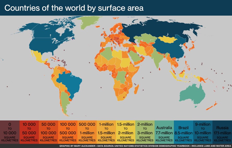
When you look at a world map, Africa might appear smaller than you expect, especially when placed next to North America. However, this visual perception is deceiving. Africa is a massive continent, and understanding its true size compared to the United States reveals some fascinating geographical facts. It’s a common misconception that Europe or even North America are larger than Africa, but the reality is quite different.
Africa is not a country, but a continent comprised of 54 independent countries. To grasp the sheer scale of Africa, consider this: it boasts a land area of approximately 11.73 million square miles (30.37 million square kilometers). In comparison, the United States, the world’s third-largest country by landmass, covers about 3.79 million square miles (9.83 million square kilometers). This means Africa is roughly three times larger than the United States.
To put this into perspective, you could fit the entire landmass of the United States into Africa three times over, and still have space left. Imagine placing the contiguous United States, along with Alaska, and even Texas again, all within the borders of Africa. This vastness is often overlooked due to the way world maps, particularly those using the Mercator projection, distort sizes, especially towards the poles. These projections often make areas in higher latitudes appear larger than they are relative to areas near the equator, where Africa is predominantly located.
Furthermore, consider the individual sizes of countries that could fit within Africa. Not only can the United States fit comfortably, but you could also include China, India, and much of Europe, with room to spare. This visual exercise helps to truly comprehend the immense scale of the African continent. Many people are surprised to learn that countries like Algeria and the Democratic Republic of Congo are each individually larger than many European nations.
The sheer size of Africa contributes to its incredible diversity – in climate, ecosystems, cultures, and populations. From the Sahara Desert to the rainforests of the Congo, and the savannas of East Africa, the continent’s geographical expanse encompasses a wide range of environments. This vast area also means that distances within Africa can be enormous, making travel and infrastructure development significant challenges.
In conclusion, while maps can be deceiving, the reality is that Africa is significantly larger than the United States. Understanding this size comparison helps to correct common misconceptions about global geography and appreciate the true scale and diversity of the African continent. Africa’s vastness is a key factor in understanding its geography, demographics, and its place in the world.